
Andover, Connecticut
Andover, Connecticut | |
|---|---|
 First Congregational Church (2017) | |
 Seal | |
  | |
   | |
| Coordinates: 41°43′58″N 72°22′29″W / 41.73278°N 72.37472°W | |
| Country | United States |
| U.S. state | Connecticut |
| County | Tolland |
| Region | Capitol Region |
| Government | |
| • Type | Selectman-town meeting |
| • First Selectman | Jonathan P. Zabel (D) |
| Area | |
• Total | 15.7 sq mi (40.7 km2) |
| • Land | 15.5 sq mi (40.0 km2) |
| • Water | 0.2 sq mi (0.6 km2) |
| Elevation | 400 ft (122 m) |
| Population (2020)[1] | |
• Total | 3,151 |
| Time zone | UTC−5 (Eastern) |
| • Summer (DST) | UTC−4 (Eastern) |
| ZIP Code | 06232 |
| Area code(s) | 860/959 |
| FIPS code | 09-01080 |
| GNIS ID | 213382 |
| Website | andoverconnecticut.org |
Andover is a rural town in Tolland County, Connecticut, United States, roughly 10 miles east of Hartford. The population was 3,151 at the 2020 census.[2]
History
[edit]Andover was incorporated on May 18, 1848, from Hebron and Coventry. The name is a transfer from Andover, Hampshire, England.[3]
Geography
[edit]According to the United States Census Bureau, the town has a total area of 15.7 square miles (41 km2), of which 15.5 square miles (40 km2) is land and 0.2 square miles (0.52 km2) (1.53%) is water. A number of small streams and rivers flow in Andover, among which are the Hop River, Burnap Brook, Skungamaug River, and Straddle Brook. Andover Lake is located in the southeastern corner of town.[1]
The town borders Coventry to the Northeast, Columbia to the Southeast, Hebron to the Southwest, and Bolton to the Northwest.
Demographics
[edit]| Census | Pop. | Note | %± |
|---|---|---|---|
| 1850 | 500 | — | |
| 1860 | 517 | 3.4% | |
| 1870 | 461 | −10.8% | |
| 1880 | 428 | −7.2% | |
| 1890 | 401 | −6.3% | |
| 1900 | 385 | −4.0% | |
| 1910 | 371 | −3.6% | |
| 1920 | 389 | 4.9% | |
| 1930 | 430 | 10.5% | |
| 1940 | 560 | 30.2% | |
| 1950 | 1,034 | 84.6% | |
| 1960 | 1,771 | 71.3% | |
| 1970 | 2,099 | 18.5% | |
| 1980 | 2,144 | 2.1% | |
| 1990 | 2,540 | 18.5% | |
| 2000 | 3,036 | 19.5% | |
| 2010 | 3,303 | 8.8% | |
| 2020 | 3,151 | −4.6% | |
| U.S. Decennial Census[4] | |||
As of the 2020 United States Census, Andover had a population of 3,151.[5]
The racial composition of the population was 89.7% white, 1.4% black or African American, 0.1% Native American, 1.1% Asian, 1.0% from some other race and 6.7% reporting two or more race. 3.8% of the population was Hispanic or Latino of any race.
As of 2021, 5.7% of the population was born outside the United States. Of the foreign-born population, 5.6% were not US citizens.[6]
As of the 2020 census, the town had 1,271 households, occupying 96% of available housing units. 2.4% of units were for seasonal, recreational, or occasional use. The population density was 200.7 inhabitants per square mile (77.5/km2). There were 1,342 housing units at an average density of 85.5 per square mile (33.0/km2). 99.8% of the town's population lived in households, with the remaining 0.2% living in noninstitutionalized group quarters.
99.8% of the town's population lived in households, with the remaining 0.2% living in noninstitutionalized group quarters.
Of the 1,271 households, 58.4% were married couples living together; 17.9% with their own children under 18. 7.5% were cohabitating couples; 1.5% with their own children under 18. 15.7% were male householders with no spouse or partner present; 10.9% living alone and 2.0% with their own children under 18. 18.4% had a female householder with no spouse or partner present; 10.4% living alone and 2.4% with own children under 18.
| Population pyramid 2020 | ||||
| % | Males | Age | Females | % |
| 1.0 | 85+ | 1.8 | ||
| 1.6 | 80–84 | 1.8 | ||
| 3.0 | 75–79 | 3.0 | ||
| 4.8 | 70–74 | 4.7 | ||
| 7.5 | 65–69 | 8.4 | ||
| 10.7 | 60–64 | 10.3 | ||
| 8.9 | 55–59 | 10.2 | ||
| 8.2 | 50–54 | 9.4 | ||
| 6.7 | 45–49 | 6.1 | ||
| 4.6 | 40–44 | 4.3 | ||
| 4.5 | 35–39 | 5.1 | ||
| 6.0 | 30–34 | 5.6 | ||
| 5.2 | 25–29 | 5.0 | ||
| 6.5 | 20–24 | 5.3 | ||
| 7.7 | 15–19 | 5.2 | ||
| 5.0 | 10–14 | 5.8 | ||
| 3.5 | 5–9 | 3.7 | ||
| 4.7 | 0–4 | 4.4 | ||
The median age was 48.9 years. 50.5% of the population was male and 49.5% female.
97.2% of the population over 25 had a high school diploma or higher. 41.5% had a bachelor's degree or higher and 19.6% had a graduate or professional degree.
As of 2021, the median household income was $102,759, and the median family income was $116,354. Males had a median income of $73,693 versus $57,212 for females. The per capita income for the town was $48,419. 1.6% of the population had an income in the past year that was below the poverty line, all between the ages of 18 and 64.
Of the 1,582 workers 16 years or older, 84.6% drove alone to work. 5.8% carpooled, 0.6% used public transportation, 0.4% walked, and 8.5% worked from home. The mean travel time to work was 26 minutes.[7]
| Ethnicity | Percent |
|---|---|
| Other |
Infrastructure
[edit]The Andover Public Library was originally opened in 1896, in the Congregational Church Conference House. It was relocated in 1927 to its present location on Long Hill Road.[2]
Transportation
[edit]The 918 Willimantic-Coventry Express, opperated by CT Transit, is a bus route that offers weekday service to Willimantic, Columbia, Coventry, Bolton, and Hartford.[9]
![]() US 6 runs roughly northwest-southeast through the center of town, connecting Andover to Willimantic and Providence, Rhode Island to the East and Bolton and Hartford to the West.
US 6 runs roughly northwest-southeast through the center of town, connecting Andover to Willimantic and Providence, Rhode Island to the East and Bolton and Hartford to the West.
![]() Route 316 begins in the center of Andover at a junction with Route 6. It runs south, connecting to the neighboring town of Hebron.
Route 316 begins in the center of Andover at a junction with Route 6. It runs south, connecting to the neighboring town of Hebron.
![]() Route 87 begins on the Eastern side of Andover at a junction with Route 6. It continues to the Southeast, connecting to neighboring Columbia and eventually terminating just outside of Norwich.
Route 87 begins on the Eastern side of Andover at a junction with Route 6. It continues to the Southeast, connecting to neighboring Columbia and eventually terminating just outside of Norwich.
Points of interest
[edit]- Andover Veterans Monument Park is located on Monument Lane in front of the Museum of Andover History. The Agent Orange Monument in memory of those who died because of Agent Orange during the Vietnam War was unveiled on June 5, 2021, at the Andover Veterans Monument Park.[10]
- Museum of Andover History is located in the Old Town Hall on Monument Lane. It traces the history of Andover since 1600.
- The Hop River State Park Trail is a rail trail which passes through Andover with multiple connections to local roads[11]
- The March Route of Rochambeua's Army passes through Andover along Route 6 and the historic Hutchinson Road[12]
- Andover Center Historic District is on the National Register of Historic Places[13]
- White's Tavern, also on the NRHP, is notable for hosting Rochambeau and other French officers during the American Revolution[14]
- Nathan Hale State Forest is partially located in and accessible from Andover[15]
Education
[edit]Andover is home to Andover Elementary School for grades K–6 while grades 7–12 go to R.H.A.M. middle and high schools.[16]
Politics
[edit]| Voter Registration and Party Enrollment as of October 31, 2024[17] | |||||
|---|---|---|---|---|---|
| Party | Active Voters | Inactive Voters | Total Voters | Percentage | |
| Republican | 710 | 17 | 727 | 29.3% | |
| Democratic | 676 | 31 | 707 | 28.5% | |
| Minor Parties | 36 | 4 | 40 | 1.6% | |
| Unaffiliated | 971 | 33 | 1,004 | 40.5% | |
| Total | 2,393 | 85 | 2,478 | 100% | |
| Presidential Election Results[18][19] | |||
|---|---|---|---|
| Year | Democratic | Republican | Third Parties |
| 2024 | 49.3% 1,032 | 49.4% 1,035 | 1.3% 27 |
| 2020 | 50.6% 1,058 | 47.7% 998 | 1.7% 35 |
| 2016 | 47.0% 896 | 46.7% 891 | 6.3% 121 |
| 2012 | 55.1% 976 | 43.7% 774 | 1.2% 22 |
| 2008 | 58.4% 1,090 | 39.9% 745 | 1.7% 31 |
| 2004 | 54.4% 980 | 44.1% 796 | 1.5% 28 |
| 2000 | 54.9% 871 | 38.2% 609 | 6.9% 111 |
| 1996 | 48.5% 711 | 32.7% 480 | 18.8% 275 |
| 1992 | 40.0% 634 | 30.2% 480 | 29.8% 472 |
| 1988 | 47.5% 604 | 50.9% 649 | 1.6% 21 |
| 1984 | 36.5% 435 | 63.5% 758 | 0.00% 0 |
| 1980 | 32.5% 374 | 47.9% 552 | 19.6% 226 |
| 1976 | 47.8% 487 | 51.6% 526 | 0.6% 6 |
| 1972 | 41.3% 446 | 57.7% 624 | 1.0% 11 |
| 1968 | 44.0% 419 | 49.1% 469 | 6.9% 66 |
| 1964 | 52.3% 556 | 47.7% 508 | 0.00% 0 |
| 1960 | 46.6% 391 | 56.4% 505 | 0.00% 0 |
| 1956 | 32.7% 240 | 67.3% 494 | 0.00% 0 |
Local government in Andover is organized by a board of selectmen, consisting of 5 members. Per the town charter, no political party can have more than three members on the board at one time. As of 2025 the first selectman was Jeffrey J. Maguire (D) and the vice first selectman was Jeffrey A. Murray (R). The board also included Scott R. Person (D), Anne Peterson Cremè (D), and one vacant seat. The next election is scheduled for 2027.[20]
The approved town budget for the fiscal year 2024-25 was $12,836,706.61.[21]
Andover is a part of District 55 for the Connecticut House of Representatives. It has been represented by Republican Steve Weir since 2023.[22] In the Connecticut State Senate, Andover is a part of District 4, represented by Democrat MD Rahman since 2023.[23] At the federal level, Andover is located in Connecticut's 2nd Congressional District, which has been represented by Democrat Joe Courtney since 2007.[24]
Notable People
[edit]- Daniel Burnap (1759-1838) - Clock-maker - Born in Andover[25]
- William Buell Sprague (1795-1876) - Congregational and Presbyterian clergyman and biographer - Born in Andover[26]
- Abby B. Hyde (1799-1872) - Hymn-writer - Died in Andover[27]
- Milton Badger (1800-1873) - Congregational Minister - Born in Andover[28]
- Theodore A. Bingham (1858-1934) - New York City Police Commissioner 1906-09 - Born in Andover[29]
References
[edit]- ^ U.S. Census Bureau Population Estimates
- ^ "Census - Geography Profile: Andover town, Tolland County, Connecticut". Retrieved November 25, 2021.
- ^ The Connecticut Magazine: An Illustrated Monthly. Connecticut Magazine Company. 1903. p. 330.
- ^ "Census of Population and Housing". Census.gov. Retrieved June 4, 2015.
- ^ "Explore Census Data". data.census.gov.
- ^ "Explore Census Data". data.census.gov.
- ^ "Explore Census Data". data.census.gov.
- ^ https://data.census.gov/table/ACSDP5Y2021.DP02?g=060XX00US0901301080&d=ACS%205-Year%20Estimates%20Data%20Profiles.
{{cite web}}: Missing or empty|title=(help) - ^ https://www.cttransit.com/sites/default/files/schedules/h_918_wkdysched.pdf.
{{cite web}}: Missing or empty|title=(help) - ^ Rodriguez Jr., Ismael. "'We've Been Fighting This for 55 Years'", VFW Magazine, volume 109, number 2, October 2021, pages 42-43.
- ^ https://ctparks.com/media/520/download?inline.
{{cite web}}: Missing or empty|title=(help) - ^ Prussia, Mailing Address: Washington-Rochambeau National Historic Trail 1400 North Outer Line Drive King of; Us, PA 19406 Phone: 610-783-1006 Washington-Rochambeau National Historic Trail Contact. "Directions - Washington-Rochambeau Revolutionary Route National Historic Trail (U.S. National Park Service)". www.nps.gov.
{{cite web}}: CS1 maint: numeric names: authors list (link) - ^ https://npgallery.nps.gov/NRHP/AssetDetail/002065d4-2fe7-4759-9543-52cc91c1de2b.
{{cite web}}: Missing or empty|title=(help) - ^ https://npgallery.nps.gov/NRHP/AssetDetail/c966a503-07ff-4be7-ad12-259779d7f824.
{{cite web}}: Missing or empty|title=(help) - ^ https://explorect.org/nathan-hale-state-forest/.
{{cite web}}: Missing or empty|title=(help) - ^ Link text
- ^ https://portal.ct.gov/-/media/sots/electionservices/2024/2024-registration-and-enrollment-statistics/2024_november_reg-party_enrollments.pdf?rev=6ea82a0b09e84203a63f918ff7741019&hash=CBA24E0CAAF8D5CB4062E3DE0BE6B6DA.
{{cite web}}: Missing or empty|title=(help) - ^ "General Election Statements of Vote, 1922 – Current". CT Secretary of State. Retrieved May 8, 2020.
- ^ "2024 Connecticut Election Results". AP News.
- ^ "Board of Selectmen | Andover, CT". www.andoverconnecticut.org.
- ^ https://www.andoverconnecticut.org/sites/g/files/vyhlif5346/f/uploads/town_of_andover_budget_fy_24-25_approved_at_referendum.pdf.
{{cite web}}: Missing or empty|title=(help) - ^ "Steve Weir". CT Mirror.
- ^ "MD Rahman". CT Mirror.
- ^ "Rep. Joe Courtney [D-CT2, 2007-2026], Representative for Connecticut's 2nd Congressional District". GovTrack.us.
- ^ "Daniel Burnap". web.archive.org. November 13, 2010.
- ^ Wilson, James Grant; Fiske, John (1900). "Appleton's cyclopaedia of American biography". New York, D. Appleton.
- ^ Hatfield, Edwin Francis (1884). "The Poets of the Church: A Series of Biographical Sketches of Hymn-writers with Notes on Their Hymns". A. D. F. Randolph.
- ^ "Badger, Milton, Dd from the McClintock and Strong Biblical Cyclopedia". McClintock and Strong Biblical Cyclopedia Online.
- ^ "6EN. BINGHAM DIES AT SUMMER HOME; Former Police Commissioner of New York Succumbs in Canada at Age of 76. RULED WITH AN IRON HAND His Rugged Leadership Brougf Political Protests -- Served in Bridge Department Also". The New York Times.
External links
[edit]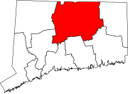
Municipalities and communities of Tolland County, Connecticut, United States | ||
|---|---|---|
| Towns |  | |
| CDPs | ||
| Other communities | ||
| International | |
|---|---|
| National | |
| Other | |